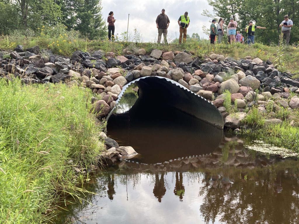
…that’s the Great Lakes Stream Crossing Inventory, for the uninitiated. Last week, my colleagues Ann and Genevieve and I had the exciting opportunity to get a little more familiar with this inventory, designed to capture a complete picture of a culvert site.

Genevieve takes a photograph of the road near a culvert site
Genevieve takes a photo of the road to assess its slope and grade compared to the culvert behind her.

Created through a group effort across multiple states and agencies (we love to see that!), the GLSC inventory is time-intensive, but highly valuable and relatively easy to carry out by trained crews. We at WICDI consider ourselves an untrained crew. Luckily, Chris Ester (US Forest Service) and Jon Simonsen (WI DNR), two of GLSCI’s project team, offered to take us under their wings. Genevieve and I masked up and drove up to Mosinee, north of Wausau, where we met Ann (who had driven from Milwaukee), Jon, and Chris.

Jon stands on a culvert pipe holding a measuring stick
Jon used a survey rod to take length, width and depth measurements (and to keep from falling in) at this culvert site on Johnson Creek.

When we got to our first culvert site, Jon handed us tablets with GLSCI’s Survey123 form loaded and ready to go. Using Survey123 allows collectors to add data in a variety of forms (text, check boxes, photos and even sketches) without a cellular or wifi connection. The data can then be uploaded once back in civilization/the office.

a plaque on a bridge showing that it was built in the 1930s
One of the sites we visited featured this bridge, built in 1935 — old school cool.

Tablets in hand, we began talking through page 1 of the survey’s 9 pages. Chris explained that while a trained crew could complete a survey in under half an hour, we should expect closer to a 90-minute window for walking through all of the questions the first time. This is definitely a time investment, but the inventory isn’t something that’s designed to be completed in full on a continual basis. Rather, once an area (say a town or a county) has completed the assessment once for all culverts, it’s much easier and quicker to add maintenance and damage updates as needed.

culvert site showing buildup from beaver activity
Beaver activity at this culvert site led to buildup of dead branches and vegetation in the water.
a stick with beaver teeth markings
More proof of beavers’ busywork — little toothmarks on the end of this branch.

The GLSCI covers everything from basic structural data — culvert material, shape, measurements — to upstream and downstream information, road characteristics, erosion assessments, and surrounding land use. Chris and Jon led us to multiple culvert sites, both to illustrate differences in these data and to take welcome breaks from the cold while driving among sites. They also patiently answered our many and varied questions, from “what does this term mean?” to “how do you estimate this number?”.

two culvert pipes in a stream
Two of this site’s three culvert pipes. The pipe on the right was nearly blocked by vegetation, causing most water to flow through the other two pipes.
a man holding a tablet with a photo of a culvert site

All crews receive training before using GLSCI on their culverts. Nonetheless, we found it incredibly helpful that the survey form includes explanatory text, guidelines for assessments, and even photo examples for many of the questions. Without knowing what “skew” or “alignment” meant prior to the trip, I was able to correctly assess the culvert-stream alignment and the culvert-road skew by using the diagrams included in the survey. The photo to the left comes from a set of examples showing degradation, aggradation, and equilibrium at a culvert site.

a culvert site with trees and vegetation downstream
Inspectors are asked to travel upstream and downstream when possible to assess stream conditions outside of the context of the culvert.

By late afternoon we’d wrapped up the survey’s final page. Chris and Jon sent us off with directions back to the freeway — not before a masked group photo, of course.

We at WICDI would like to say a huge thank you to Jon and Chris, as well as to the entire GLSCI team. This survey is already being rolled out across northern Wisconsin, with plans to expand over time. We have been working to ensure that our WICDI culvert database can easily ingest data from GLSCI. If you are curious about GLSCI or have any related questions, feel free to reach out to the people listed below, especially if you are interested in receiving training like we did. As always, thanks for reading and have a wonderful week!

a group of people wearing masks and standing near a culvert site
Chris, Genevieve, Melanie, and Jon posing next to our final culvert site of the day. Photo credit goes to Ann – thank you!

Chris Ester: christopher.ester@usda.gov
Jon Simonsen: jonathan.simonsen@wisconsin.gov
Mike Rubley: rubleym1@michigan.gov
Chris Collier: chris.collier@tu.org

Leave a Reply

Your email address will not be published. Required fields are marked *